


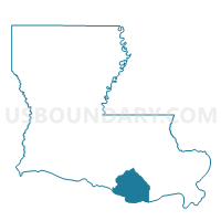
Precinct 76, Terrebonne Parish, Louisiana
About
Outline

Summary
| Unique Area Identifier | 591091 |
| Name | Precinct 76 |
| County | Terrebonne Parish |
| State | Louisiana |
| Area (square miles) | 0.97 |
| Land Area (square miles) | 0.96 |
| Water Area (square miles) | 0.01 |
| % of Land Area | 99.46 |
| % of Water Area | 0.54 |
| Latitude of the Internal Point | 29.74522940 |
| Longtitude of the Internal Point | -90.81719960 |
Maps


Graphs
Select a template below for downloading or customizing gragh for Precinct 76, Terrebonne Parish, Louisiana


Neighbors
Neighoring Voting District (by Name) Neighboring Voting District on the Map
- Precinct 1, Terrebonne Parish, LA
- Precinct 4, Terrebonne Parish, LA
- Precinct 5, Terrebonne Parish, LA